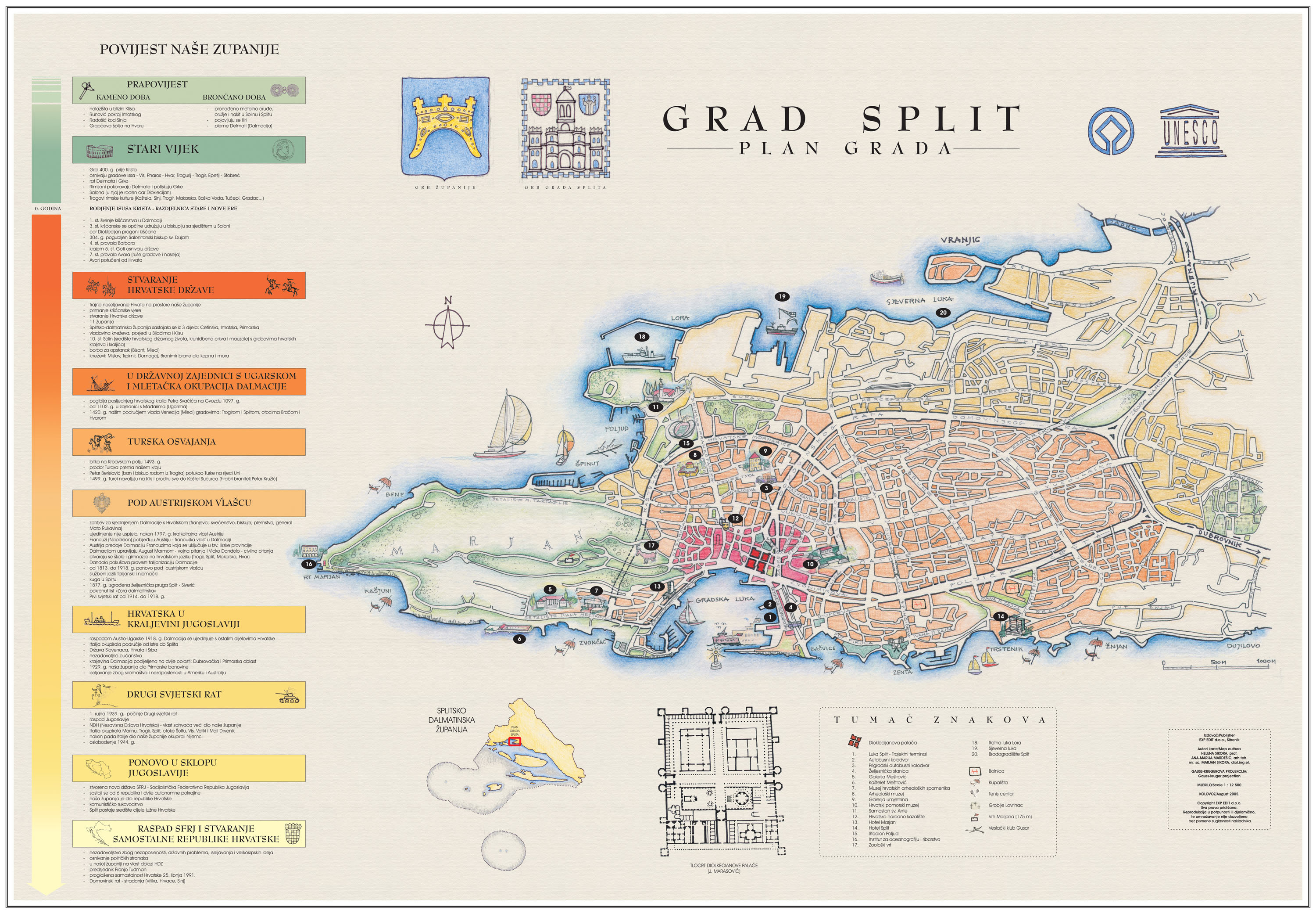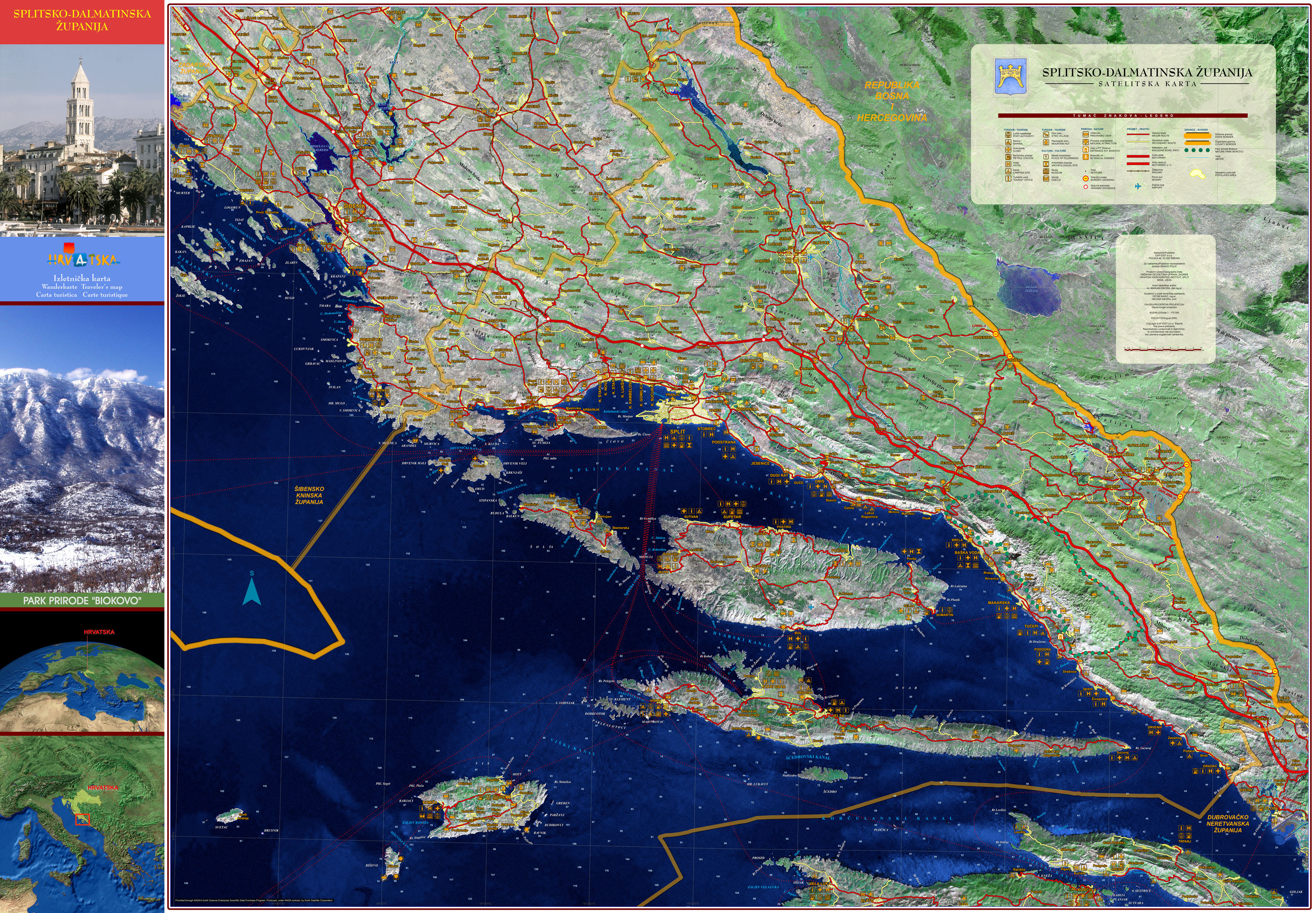
As an addition to the manual "SPLIT-DALMATIA REGION", and for the purpose of free distribution, a satellite map of Split-Dalmatia region has been made. The map was designed in 1 : 175 000 scale, with emphasis on tourist interests. On the backside the historical line of the region is placed, also with the handmade plan of the city of Split.